Road trip
Route 9 · South of Nanaimo: Coal, Carvings & the Nanaimo River
- Driving
- ≈ 110 km loop, 2 h behind the wheel
- Day
- 6–7 hours with lunch
- Terrain
- Highway, gravel trailhead lots, short forest trails
- Season
- Any; Sunday May–Oct for the Cedar market; Feb–Apr for sea lions
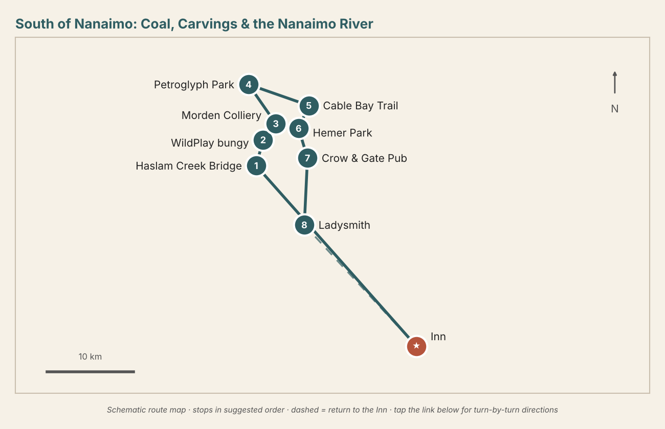
The country between Ladysmith and Nanaimo is Snuneymuxw territory and was coal country for a century. Most people drive straight through it on Highway 1. This loop stops instead: a suspension bridge, a bungy jump over a river canyon, a 1913 mine headframe, carvings in sandstone, sea lions at a tidal rapid, and an English pub for lunch. Route 3 follows the coast past some of the same country; this one stays inland and on the back roads of Cedar and Yellow Point.
- Haslam Creek Suspension Bridge — A cable bridge high over a mossy creek canyon on the Trans Canada Trail, reached by an easy forest walk from the Timberlands Road trailhead near Cassidy. Allow 45 minutes; the trail is muddy after rain.
- WildPlay Nanaimo River — Canada's first legal bungy jump, about 150 feet off a bridge into the Nanaimo River canyon, plus a giant swing, zipline and treetop course. Book a jump ahead. Watching from the bridge is free and almost as entertaining. Hours are reduced from fall to spring.
- Morden Colliery Historic Provincial Park — A 22 m concrete headframe and coal tipple built in 1913, one of only two of its kind left in North America. It was restored in 2021. Park on Morden Road and walk two minutes to it. The old rail grade continues east toward the Nanaimo River with interpretive panels on the mining families. Day use only, no services.
- Petroglyph Provincial Park — A short forest path to Snuneymuxw carvings in sandstone: sea creatures, birds and human figures. Make rubbings from the replica castings by the trailhead. Don't touch or walk on the originals, which remain sacred.
- Cable Bay Trail & Dodd Narrows — A forest trail from Nicola Road in Cedar down to the shore, then along the cliffs to Dodd Narrows. The tide pours through the gap between Vancouver Island and Mudge Island here. From about February to April, dozens to hundreds of Steller and California sea lions gather to feed on herring, and you'll hear them before you see them. Allow 1½ hours return; the way out is uphill.
- Hemer Provincial Park — Flat trails along Holden Lake through a former family estate. It's a gentle stroll with herons, ducks and turtles sunning on logs in summer.
- Crow & Gate Pub, Cedar — Lunch at BC's first neighbourhood pub: pegged beams, fireplaces, a duck pond and a ploughman's plate. Adults only (19+). On Sunday mornings from about May to October, the Cedar Farmers' Market fills the field next door with produce, baking and crafts.
- Yellow Point Road to Ladysmith — Take the slow way south past farm stands, a cranberry farm and glimpses of the Strait. End with an ice cream at Transfer Beach or a late cinnamon bun on First Avenue. It's 20 minutes home on Highway 1.
Also nearby: the honeycomb sandstone and tide pools at Roberts Memorial Park (best at low tide), Yellow Point Lodge, and Jack Point & Biggs Park near Duke Point, a sandstone-spit walk with views back over Nanaimo harbour. Swap any of these in for the bungy if nobody is jumping.